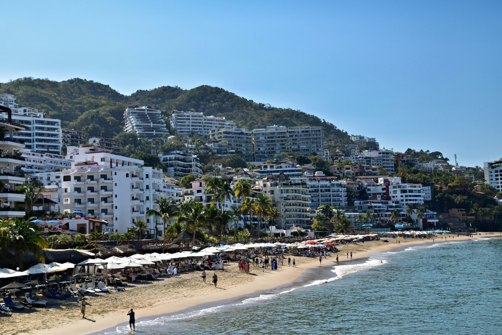
Hurricanes share a name, but the storms that hit Los Cabos and Puerto Vallarta form in a different weather system than the ones that hit Cancún and the Riviera Maya. The eastern Pacific season starts earlier than the Atlantic season, and the mountains sitting close to the coast in places like Puerto Vallarta bring runoff and wind risks that flat Caribbean terrain simply doesn't have. Hurricane Solution has worked both coasts since 2008, with assessment protocols built for each region rather than one generic approach applied everywhere.
Two Coasts, Two Different Hurricane Systems
It's easy to assume "hurricane season" means the same thing everywhere in Mexico. It doesn't. The country sits between two entirely separate hurricane basins: the Atlantic basin, covering the Gulf of Mexico and the Caribbean, which drives storms toward Cancún, Playa del Carmen, and the Riviera Maya; and the eastern Pacific basin, which drives storms toward Los Cabos, Puerto Vallarta, Mazatlán, and Acapulco.
The practical result: peak risk doesn't land on the same calendar for both coasts. The eastern Pacific season typically starts in mid-May, roughly two weeks ahead of the official Atlantic season, which begins June 1. For a hotel group with properties on both coasts, that gap matters when scheduling installation or pre-season maintenance.
Puerto Vallarta: When the Mountains Change the Equation
Puerto Vallarta and much of the Jalisco and Nayarit coastline have a feature the Riviera Maya doesn't: mountains sitting close to the shoreline. That has two direct consequences for hotel protection in the area.
First, runoff during heavy hurricane-related rain behaves differently on sloped terrain than on the flat, karstic ground of the Caribbean coast. Low-lying areas near the shore face higher flash-flooding risk, instead of the slower surface pooling typical of flat terrain.
Second, the interaction between hurricane winds and mountainous terrain can create more complex localized wind patterns, including channeling effects in coastal valleys that intensify wind speed in specific areas of a property.
Los Cabos: Direct Exposure at the Tip of the Peninsula
Los Cabos, at the southern tip of the Baja California peninsula, has a different setup entirely: direct exposure to both the Pacific and, to some extent, the Sea of Cortez, without the buffer that mainland mass gives other regions. Hurricane Odile, which struck the area in 2014 as a Category 3 storm and caused extensive damage to hotel infrastructure, made that exposure clear — and, according to local tourism industry reports, pushed hotel groups in the region to adopt stricter protection standards.
Why a Protocol Copied From the Riviera Maya Falls Short
A pattern shows up occasionally: properties expanding their brand from the Riviera Maya into Los Cabos or Puerto Vallarta try to apply the same Caribbean protection protocol without adjusting for topography, season calendar, or the Pacific's specific storm patterns. The instinct makes sense from a corporate-standardization standpoint, but it can leave real gaps — particularly in water management on sloped properties, where the dominant risk differs from what the Riviera Maya faces.
The engineering behind Level E certification and the evaluation of the four simultaneous forces — wind, water, impact, and differential pressure — applies the same way on the Pacific as it does in the Caribbean. These are universal engineering principles, not basin-specific ones. What changes is the property-level assessment: Puerto Vallarta needs runoff management on sloped terrain built in; Los Cabos needs facade exposure evaluated across multiple orientations, given the water bodies surrounding the peninsula.
Mazatlán and Acapulco: Variability Within the Same Pacific Basin
Mazatlán and Acapulco, also on the Pacific but in different locations than Los Cabos and Puerto Vallarta, show their own variations within the same hurricane system. Acapulco, still living with the memory of Hurricane Otis in 2023 — which intensified from a tropical storm to a Category 5 hurricane in under 24 hours and caught most of the area's infrastructure unprepared — is a reminder that intensity variability within the same basin can be extreme. Protection needs to be designed for the toughest scenario, not the historical average.
That rate of intensification means planning based only on a region's average historical behavior can seriously underestimate real risk. For Los Cabos and Puerto Vallarta, protection needs to treat rapid intensification as a real possibility, not an exception, rather than assuming there will always be several days of advance warning before a major storm hits.
The Risk Doesn't Stop at the Property Line
The hotel industry in Los Cabos and Puerto Vallarta makes up a significant share of Mexico's international tourism, with guests coming largely from the U.S. and Canadian markets. A prolonged closure after a major hurricane doesn't just hurt one hotel — it affects how reliable the entire destination looks, a factor that, per general industry analysis, can affect future bookings well beyond the property that was damaged. That destination-level reputational risk rarely enters the financial calculation for protection investment, but it matters especially in markets where international perception directly drives booking volume across the whole region.
Riviera Maya (Caribbean) vs. Los Cabos / Puerto Vallarta (Pacific)
| Factor | Riviera Maya (Caribbean) | Los Cabos / Puerto Vallarta (Pacific) |
|---|---|---|
| Formation basin | Atlantic | Eastern Pacific |
| Season start | June 1 | Mid-May, approximately |
| Typical topography | Flat, karstic terrain | Sloped terrain (Puerto Vallarta) or peninsula exposure (Los Cabos) |
| Dominant water risk | Surface pooling from limited drainage | Fast runoff in mountainous areas |
| Reference historical event | Hurricane Wilma (2005), Delta (2020) | Hurricane Odile (2014), Otis (2023) |
What to Do If You Manage a Property on Mexico's Pacific Coast
- Identify whether your property is in Puerto Vallarta, Los Cabos, or elsewhere on the Pacific coast, and whether you're using a generic protocol or one adapted to your geography.
- On sloped terrain, prioritize a water-management and runoff assessment alongside opening protection — not just windows and doors copied from a Caribbean protocol.
- If your property faces direct exposure to multiple bodies of water, as is common in Los Cabos, request an exposure assessment across the different facade orientations.
- Adjust your installation or maintenance schedule to account for the Pacific season starting earlier than the Atlantic one.
- If you manage properties on both Mexican coasts, avoid a single standardized protocol — request property-specific technical assessments by basin, topography, and season calendar.
To understand water management as part of the complete building envelope, especially relevant on sloped terrain, or to learn about our hotel protection for any Mexican coast, you can request a technical assessment for your property.
Treating protection in Los Cabos or Puerto Vallarta as a straight copy of the Riviera Maya protocol ignores real differences in basin, calendar, and topography. Odile in Los Cabos and Otis in Acapulco confirm that Mexico's Pacific coast faces a risk just as real as the Caribbean's — and one that calls for an assessment built around each coast's specific conditions.
Frequently Asked Questions
Do Los Cabos and Puerto Vallarta face the same hurricane risk as Cancún?
The risk is real on both coasts, but the patterns differ: different formation basin, different season calendar, and different coastal topography. That means each region needs its own technical assessment rather than assuming they're interchangeable.
When should I install hurricane protection if my property is on Mexico's Pacific coast?
Since the eastern Pacific season typically starts in mid-May, nearly two weeks before the Atlantic season, it's best to finish installation or preventive maintenance before that date, rather than using June 1 as the single reference point for the entire Mexican coastline.
Why does Puerto Vallarta's topography change the type of protection needed?
Mountains close to the coast create a runoff pattern different from flat terrain, with a higher risk of flash flooding in low-lying areas during heavy rain. That calls for dedicated water-management planning on top of standard opening protection.
What happened with Hurricane Otis in Acapulco, and why does it matter?
Otis intensified from a tropical storm to a Category 5 hurricane in under 24 hours in 2023 — one of the fastest intensification rates ever recorded in the Pacific — and caught most of the area's infrastructure unprepared. It's a reminder that protection needs to be designed for rapid-intensification scenarios, not just average historical behavior.
Does Hurricane Solution have real experience on Mexico's Pacific coast, or just the Caribbean?
Hurricane Solution has operated in Los Cabos, Puerto Vallarta, Mazatlán, and Acapulco since 2008, with the same operational continuity as in the Riviera Maya, using assessment protocols adapted to each region's specific conditions.